Welcome to the IceAGE3 blog on the MerMet 17-6 cruise on R/V Sonne!
Having completed a 3-day quarantine in the hotel room with lovely service and loads of delicious meals, everyone got a negative result for the Corona test – meaning that all of us (ship’s crew, ROV team and science group) were free to board R/V Sonne for a 5-week cruise around Iceland.
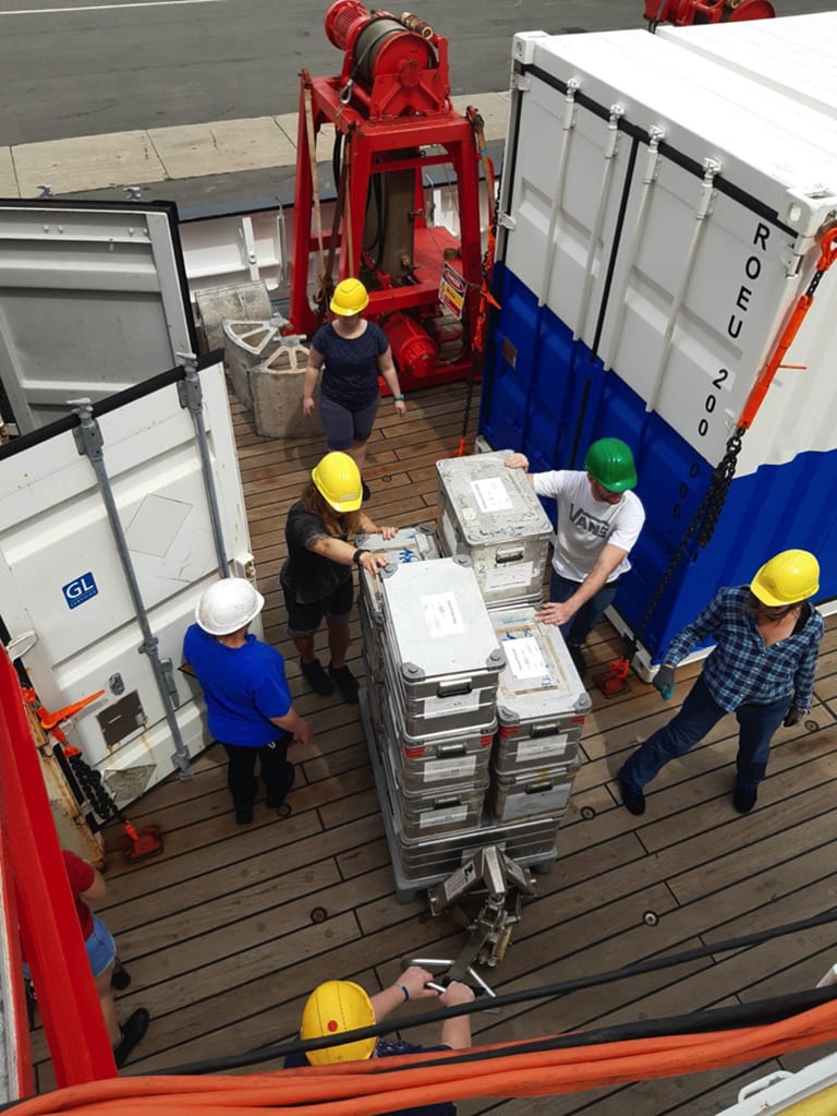
Once arriving aboard, we were shown the (single!) cabins and after a short lunch break we started unpacking the containers. Such a large amount of equipment! There is the benthic sledge which is being dragged over the seafloor trying to collect representative samples of the seafloor. There is the box corer and the MUC (mulitcore), both giving us the chance to sample seafloor at distinct points to know precisely where the probe is from. Last (but certainly not least!) comes the plankton net that sweeps through the water column collecting the smallest, yet one of the most important, species in the marine food chain. For nearly every observation or measurement being made in (ocean) waters it is crucial to know three basic parameters: salinity (i.e. conductivity), temperature, and the pressure (depth) at which those measures are taken (and of course position and time, because of seasonal and temporal variations of the measures). The instrument that provides us with those important values is called a ‘CTD’ and basically consists of a steel construction holding bottles which can be opened (and closed) at certain depths to sample sea water. By knowing salinity, temperature and depth, the local sound velocity can be derived. This is, among others, essential to consider for bathymetry mapping, i.e. acoustically strobing the seafloor to get an idea about the topography. Mapping is done with a multibeam echosounder that is installed on the hull of the vessel. It operates by transmitting acoustic energy waves through the water column. They are reflected by the ocean floor and from the time the signal needs to travel back to the echosounder, the water depth can be calculated. Using the strength (intensity) of the reflected signal gives information about seafloor characteristics. Having a high-resolution map is the basis to all further operations as, to mention only one reason, we don’t want to crash the expensive equipment into a seamount (or destroy that seamount, either!).
And now, a spoiler for what is coming up in the next days/weeks: Probably the most exciting instrument on board R/V Sonne, ‘Kiel 6000’, is waiting on the quarterdeck for its launch…stay tuned if you’d like to meet him and get insights to real deep-sea science! More on this will follow!